Home

Please support mflenses.com if you need any graphic related work order it from us, click on above banner to order!

SearchSearch MemberlistMemberlist RegisterRegister ProfileProfile Log in to check your private messagesLog in to check your private messages Log inLog in

Detroit River Panorama from Slides
View previous topic :: View next topic  


PostPosted: Wed Mar 17, 2010 5:44 pm    Post subject: Detroit River Panorama from Slides Reply with quote

This is a stitched panorama of downtown Detroit, Michigan (on the right) and Windsor, Ontario, Canada (on the left). The Detroit River separates these two towns. For those who like geographical trivia (especially those overseas who don't know it) Windsor is actually South of Detroit. This is the only place where a part of Canada is south of any part of the United States.

This panorama is made from two photos taken with a Yashica Electro 35 GSN and I used Fuji Sensia 100 color slide film. I used Hugin to stitch it together and was surprised how well it worked with scanned slides. I scanned the slides with a Canon Canoscan 4400F scanner.


PostPosted: Wed Mar 17, 2010 6:01 pm    Post subject: Reply with quote

Very nice result too! The GSN never ceases to amaze me


PostPosted: Wed Mar 17, 2010 8:49 pm    Post subject: Re: Detroit River Panorama from Slides Reply with quote

PAW-prints wrote:
For those who like geographical trivia (especially those overseas who don't know it) Windsor is actually South of Detroit. This is the only place where a part of Canada is south of any part of the United States.


Only if you pretend Alaska doesn't exist. Very Happy


PostPosted: Thu Mar 18, 2010 1:48 am    Post subject: Re: Detroit River Panorama from Slides Reply with quote

Scheimpflug wrote:

Only if you pretend Alaska doesn't exist. Very Happy


I'm sorry, I meant directly south of the U.S., and maybe that bit of trivia only refers to the continental U.S.

I just checked my map and the only part of British Columbia that is directly south of Alaska (along longitudinal lines) are the Queen Charlotte Islands. The rest of Alaska is either to the West or the South of British Columbia and Yukon.


PostPosted: Thu Mar 18, 2010 3:17 am    Post subject: Reply with quote

Detroit and Windsor may be the only big cities that meet the criteria, so that could be it. But there are several other places where the border makes some zig-zags within the continent... For example, in the Niagara Falls region:
http://maps.google.com/?ie=UTF8&ll=43.085188,-79.051781&spn=0.069957,0.169086&z=13

as well as a number of small cuts in other areas:
http://maps.google.com/?ie=UTF8&ll=48.477473,-92.653198&spn=0.253995,0.676346&z=11


But regardless, I didn't mean to derail the thread - your panorama turned out great! Hugin is definitely an amazing piece of software. Cool Did you take the photos intending to stitch them, or did you decide to merge them after the fact? How big is the full-size image?


PostPosted: Thu Mar 18, 2010 6:18 am    Post subject: Reply with quote

great, nice results with Hugin


PostPosted: Thu Mar 18, 2010 3:02 pm    Post subject: Reply with quote

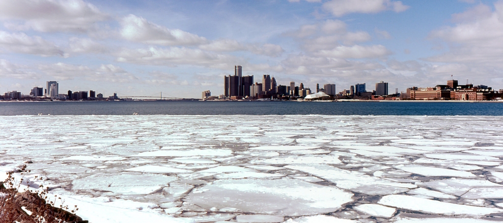
Great shot and results from Hugin


patrickh


PostPosted: Fri Mar 19, 2010 1:24 am    Post subject: Reply with quote

Thank you very much for the comments and further geographical information. Smile

I did take the photos with the idea to try to stitch something together. Though I only took two handheld photos with my GSN for this purpose.

The largest version I have of this photo is 1648x731 pixels, though I don't think I scanned it at the highest resolution of my scanner, so I possibly could go higher.

I have had some good luck with Hugin, and I will certainly do more when and where the situation presents itself.


PostPosted: Fri Mar 19, 2010 1:46 am    Post subject: Re: Detroit River Panorama from Slides Reply with quote

Maybe I have not understood correctly... but as an ex Michigan resident, isn't much of Canada south of Alaska, which when I last looked was still (even in Sarah Palin's weird world) part of the USA or was the piece meant to mean the only bit of Canada South of all of the USA (but not of course South of Hawaii - another of the late joining states)?? lol


Doug

PAW-prints wrote:
This is a stitched panorama of downtown Detroit, Michigan (on the right) and Windsor, Ontario, Canada (on the left). The Detroit River separates these two towns. For those who like geographical trivia (especially those overseas who don't know it) Windsor is actually South of Detroit. This is the only place where a part of Canada is south of any part of the United States.

This panorama is made from two photos taken with a Yashica Electro 35 GSN and I used Fuji Sensia 100 color slide film. I used Hugin to stitch it together and was surprised how well it worked with scanned slides. I scanned the slides with a Canon Canoscan 4400F scanner.