| View previous topic :: View next topic |
| Author |
Message |
cooltouch


Joined: 15 Jan 2009
Posts: 9097
Location: Houston, Texas
|
 Posted: Thu Oct 13, 2016 2:59 pm Post subject: 1995: Road trip from Southern CA to Washington State. Posted: Thu Oct 13, 2016 2:59 pm Post subject: 1995: Road trip from Southern CA to Washington State. |
 |
|
cooltouch wrote:
Back in 1995, my "family" and I decided to take a road trip from our home city of Whittier, California (east Los Angeles County) up to Victoria, British Columbia. We rented a 28' motor home for the "vacation," and set off during the first week of June. I put quotes around "family" because it was my wife and 4yo daughter and I, plus my wife's mother, her niece, and her neice's friend. Yup, me and five females. Cooped up in a motor home for the better part of two weeks. Hence the reason why I put quotes around "vacation." To make matters even more interesting, I was suffering from rather severe bouts of sciatica at the time and, of course, none of the women would drive that beast, so I was the only one who drove. For some 3,000 miles.
I brought a small Nikon F2 outfit with me, which included a preset Century Precision Optics 500mm f/5.6 Tele Athenar II telephoto. As situations would have it, I ended up using that Century telephoto for probably most of the images I shot. Other optics were all Nikkors: a 28mm f/3.5, a 35mm f/2, a 105mm f/2.5 and an 80-200mm f/4.5 zoom. I shot Fujichrome 100 and some sort of print film during the trip. The photos here are dupes I shot of the Fujichromes, using my NEX 7 and a dupe rig I put together. The scans I had of the C-41 images were lost in a hard drive crash and I haven't rescanned them again, so I don't have any of the print images to show you.
We set out from the LA area, eventually hooking up with US 395, which runs north-south through eastern California along the eastern edge of the Sierra Nevada mountains. It also just happened to go right by Mt. Whitney, the tallest peak in the contiguous United States at 14,505 feet (4421.0 m). From where we were, it did tend to dominate the western horizon.
I don't recall the focal length lenses I used on these first couple of shots. If I had to guess, though, I'd say the first one was with a Nikkor 28/3.5 and the second was a Nikkor 105/2.5. Mt. Whitney is the tallest peak in the background.


These next two photos are of Mt. Whitney, taken with the Century 500mm telephoto.


Moving on up US 395 a ways and we stopped off at a small pocket lake recommended to us by our neighbors. Called June Lake, it's just a small jog off of 395. Our neighbors really talked the place up. Well, it was picturesque enough and all but to be honest, the lake itself was kinda boring. We only stayed a few hours.

We continued up US 395 to Reno, where we stopped off for the night. I didn't get any shots of Reno. I stayed in the motor home, resting my aching back. From Reno, we headed back into California and hooked up with state highway 20, taking it all the way to Interstate 5. We traveled up I-5 to Mt. Shasta National Forest, where we put in for the night. I managed only a few shots of Mt. Shasta while we were there. My back again.

Up into Oregon, our next touristy stop of any significance was Crater Lake. Now, bear in mind this was the first week of June, but up at Crater Lake, there was still a lot of snow on the ground. I managed only a few shots of the lake, ducking murderous swarms of dive-bombing mosquitos, but they were enough where I was able to assemble a halfway decent panorama of the lake:

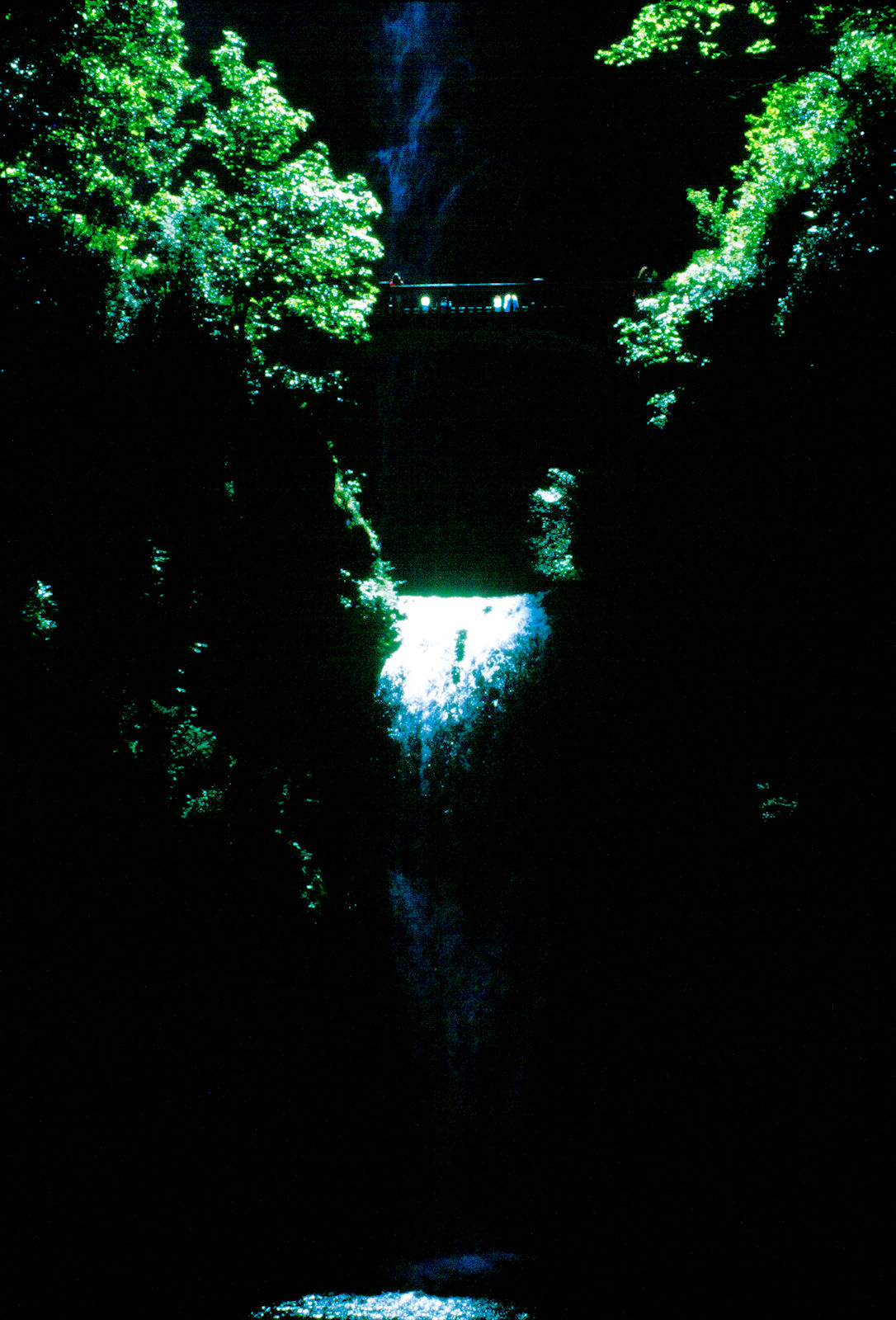
Somewhere east of Portland, we stopped off at another touristy spot that featured a really tall waterfall. I only got a few slide images from this place, but I do recall shooting some print film at this location. Anyway, here's a shot of the waterfall. I don't recall the name of the place.

We pretty much just drove through Portland and on into Washington State. I had a couple places I wanted to see: Mt. St. Helens, and Mt. Rainier. I was stationed at Ft. Lewis when I was in the Army back in the 70s and Mt. Rainier was such a dominant feature of the landscape from the fort. And, of course, I wanted to see Mt. St. Helens just to see what a blown-out volcano looks like.
We arrived within the vicinity of Mt. St. Helens first. We were still quite a ways away when we came to a lookout where it was easy to see. I wanted to drive closer, but the women were grousing about having to put up with looking at some blown up volcano that they didn't care about, so I didn't press matters. As you can see from the photos, there are at least a couple of mountain ridges between the volcano and where we were.
The first shot is with the Century 500. The second is with the Century 500 plus a Vivitar macro-focusing 2x teleconverter. If you look closely, you can see a new dome being formed within the caldera. Given that this was 1995 and the eruption occurred in 1980, I imagine that dome is a lot bigger now.


And finally, this is where my slides ran out. At Mt. Rainier National Park. I shot at least a roll of film there, but most of the images are duplicates. Here are a few good ones of Mt. Rainier:


Our trip continued into Victoria, British Columbia, where we turned around and headed back south down US 101. I must have been shooting negative film only by then because I have no more slides of this or the remainder of the trip. If/when I get them scanned I will revisit this threat with more images.
_________________
Michael
My Gear List: http://michaelmcbroom.com/photo/gear.html
My Gallery: http://michaelmcbroom.com/gallery3/index.php/
My Flickr Page: https://www.flickr.com/photos/11308754@N08/albums
My Music: https://soundcloud.com/michaelmcbroom/albums
My Blog: http://michaelmcbroom.com/blogistan/ |
|
| Back to top |
|
 |
konicamera


Joined: 03 May 2009
Posts: 746
Location: Warsaw, Poland
Expire: 2014-06-14
|
| Posted: Thu Oct 13, 2016 3:26 pm Post subject: Re: 1995: Road trip from Southern CA to Washington State. |
|
|
konicamera wrote:
| cooltouch wrote: |
Somewhere east of Portland, we stopped off at another touristy spot that featured a really tall waterfall. I only got a few slide images from this place, but I do recall shooting some print film at this location. Anyway, here's a shot of the waterfall. I don't recall the name of the place.
|
Perhaps a little south of Portland? Looks like Silver Creek Falls near Salem, just east of I-5. I spent some time in Corvallis OR a few decades back. The Pacific Northwest is one of the most beautiful areas I've ever been to. Thanks for the memories. Great shots!
_________________
L'homme s'ennuie du bien, cherche le mieux, trouve le mal, et s'y soummet, crainte du pire. - Duc François-Gaston de Lévis
While it is nice to be important, it's more important to be nice.
URL: www.konicafiles.com
|
|
| Back to top |
|
|
cooltouch
Joined: 15 Jan 2009
Posts: 9097
Location: Houston, Texas
|
| Posted: Fri Oct 14, 2016 1:19 am Post subject: |
|
|
cooltouch wrote:
Ok, it was over 20 years ago, so it's all coming back to me now. Because we wanted to visit Crater Lake in Oregon, we parted ways with Interstate 5 in Weed, California, and took US 97 north into Oregon. After visiting Crater Lake we stayed on US 97 all the way up to I-84, which we took west into Portland. I dunno, we might have taken US 197 north of Bend. Probably did. Now it was somewhere along I-84 that we must have seen signs and decided to pull over. I just went back and had a look on Google maps. I found several falls, but none of them look like these. So the mystery remains.
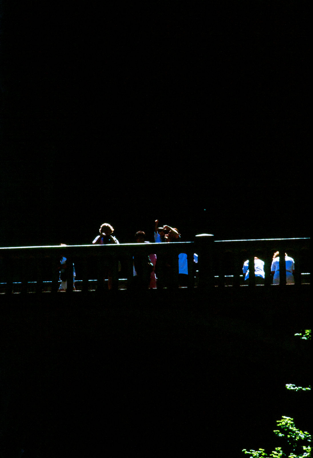
The falls don't really look like it in that photo, but they're actually quite tall. And there is a foot bridge that crosses in front of it as well that's also pretty high up there. Here are a couple of shots that sorta show what I'm talking about.


I agree with you about the Pacific Northwest, absolutely. I'm a born and raised Texan and proud of it, but if I had my choice of a place to live anywhere in the world, it would be along the southern Oregon coast.
_________________
Michael
My Gear List: http://michaelmcbroom.com/photo/gear.html
My Gallery: http://michaelmcbroom.com/gallery3/index.php/
My Flickr Page: https://www.flickr.com/photos/11308754@N08/albums
My Music: https://soundcloud.com/michaelmcbroom/albums
My Blog: http://michaelmcbroom.com/blogistan/ |
|
| Back to top |
|
|
kds315*

Joined: 12 Mar 2008
Posts: 16544
Location: Weinheim, Germany
Expire: 2021-03-09
|
| Posted: Fri Oct 14, 2016 5:13 am Post subject: |
|
|
kds315* wrote:
 wonderful images + story Michael! wonderful images + story Michael!
_________________
Klaus - Admin
"S'il vient a point, me souviendra" [Thomas Bohier (1460-1523)]
http://www.macrolenses.de for macro and special lens info
http://www.pbase.com/kds315/uv_photos for UV Images and lens/filter info
https://www.flickr.com/photos/kds315/albums my albums using various lenses
http://photographyoftheinvisibleworld.blogspot.com/ my UV BLOG
http://www.travelmeetsfood.com/blog Food + Travel BLOG
https://galeriafotografia.com Architecture + Drone photography
Currently most FAV lens(es):
X80QF f3.2/80mm
Hypergon f11/26mm
ELCAN UV f5.6/52mm
Zeiss UV-Planar f4/60mm
Zeiss UV-Planar f2/62mm
Lomo Уфар-12 f2.5/41mm
Lomo Зуфар-2 f4.0/350mm
Lomo ZIKAR-1A f1.2/100mm
Nikon UV Nikkor f4.5/105mm
Zeiss UV-Sonnar f4.3/105mm
CERCO UV-VIS-NIR f1.8/45mm
CERCO UV-VIS-NIR f4.1/94mm
CERCO UV-VIS-NIR f2.8/100mm
Steinheil Quarzobjektiv f1.8/50mm
Pentax Quartz Takumar f3.5/85mm
Carl Zeiss Jena UV-Objektiv f4/60mm
NYE OPTICAL Lyman-Alpha II f1.1/90mm
NYE OPTICAL Lyman-Alpha I f2.8/200mm
COASTAL OPTICS f4/60mm UV-VIS-IR Apo
COASTAL OPTICS f4.5/105mm UV-Micro-Apo
Pentax Ultra-Achromatic Takumar f4.5/85mm
Pentax Ultra-Achromatic Takumar f5.6/300mm
Rodenstock UV-Rodagon f5.6/60mm + 105mm + 150mm
|
|
| Back to top |
|
|
cooltouch
Joined: 15 Jan 2009
Posts: 9097
Location: Houston, Texas
|
| Posted: Mon Jan 16, 2017 4:53 pm Post subject: |
|
|
cooltouch wrote:
I just happened to come across this semi-stale thread that I started back in October, and reading through what I wrote, I realized that I was incorrect when I wrote that I ran out of slide film at Mt. Rainier. My wife had an old friend who lived in Bremerton, which is on the west side of Puget Sound, so we decided to go visit them. It was night as we were pulling into Bremerton. I was driving (of course) and happened to notice that we were driving past a rather large US Navy ship yard, and I noticed some hull numbers I recognized, like [BB] 62 and 63. Battleships! But not just any class of battleships -- these were Iowa class. The biggest and the baddest of them all. And there were a bunch of carriers too!
When we got to my wife's friend's house, I asked her husband about what I saw, and he said, "Sure, that's Battleship Row." They had the USS Missouri and New Jersey more or less permanently moored there, along with about a half-dozen mothballed carriers. So the next day, I set out to visit Battleship Row. The Missouri was open to tourists, but the New Jersey, which was moored alongside the Missouri, was not.

The "Mighty Mo."

A nice little family pose, the kids perched atop Mo's 16-inch guns. I didn't know them, but I liked the way the scene looked, so I fired away.


A bronze plaque embedded into the deck of the USS Missouri, noting the exact spot where the instruments of surrender were signed, bringing to a conclusion WWII:

Getting to walk through the open areas of the Missouri was an incredible experience. One thing I noticed about her was that she had been very carefully mothballed, meaning that, if she ever had to be reactivated, it wouldn't be very difficult to do. The Iowa class were the last and the greatest battleships ever built. Only four of them were built: the Iowa, the Missouri, the New Jersey, and the Wisconsin. A few years after I visited Battleship Row, it was no more. The Missouri was moved to Pearl Harbor, Hawaii, permanently moored as a Naval museum ship, and the New Jersey was moved to New Jersey. She is now permanently moored in Camden, New Jersey and has been converted into a Naval museum.
_________________
Michael
My Gear List: http://michaelmcbroom.com/photo/gear.html
My Gallery: http://michaelmcbroom.com/gallery3/index.php/
My Flickr Page: https://www.flickr.com/photos/11308754@N08/albums
My Music: https://soundcloud.com/michaelmcbroom/albums
My Blog: http://michaelmcbroom.com/blogistan/ |
|
| Back to top |
|
|
|
|
|
You cannot post new topics in this forum
You cannot reply to topics in this forum
You cannot edit your posts in this forum
You cannot delete your posts in this forum
You cannot vote in polls in this forum
|